
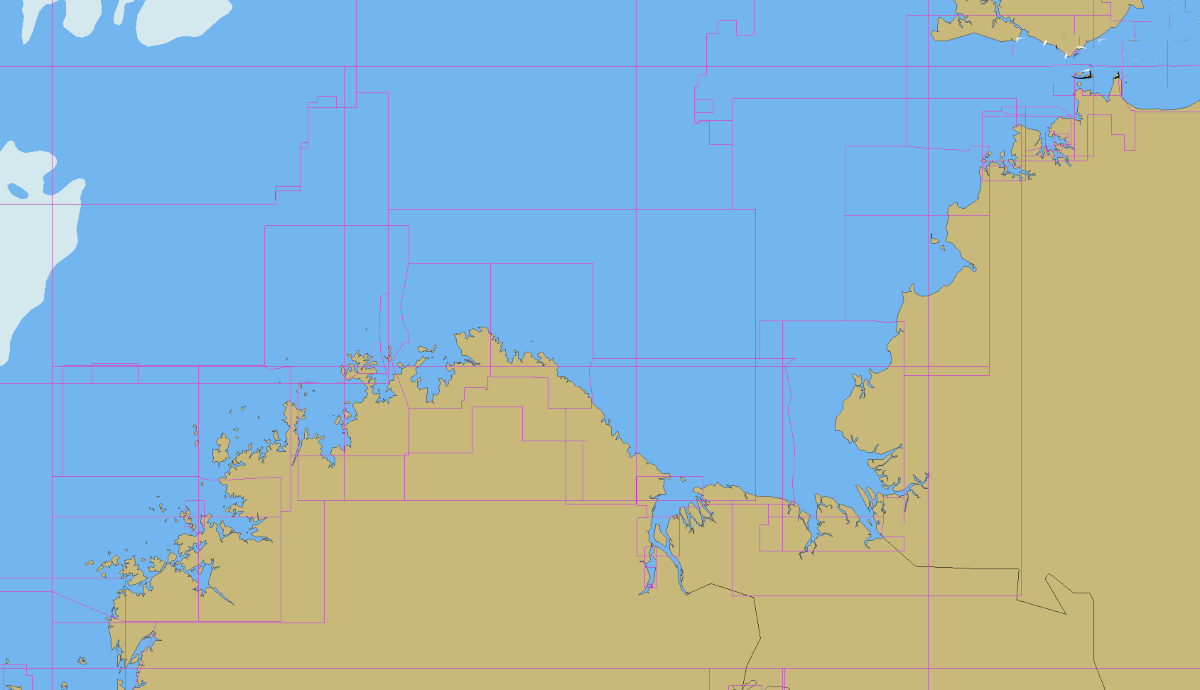
After an extended stay in Darwin, we left for the Kimberley on 1st August. We were keen to get south the rugged coastline of the sandstone country, so spend south hugging the eastern shore of the Joseph Bonaparte Gulf as South-East winds to 30 knots blew offshore. Some of the bays along this coast are rather deep, and crossing the mouth of Anston Bay with a fetch of 10 miles, the fresh breeze blew up a substantial wind chop. After stopping overnight at Bare Island, Blaze Point and Port Keats, we then had an 80 mile hop across to Lacrosse Island in the mouth of the Ord River. With the breeze doing the typical northern Australia thing, of blowing fresh offshore land breeze in the early morning, and onshore sea breeze in the afternoon, punctuated with a period of calm between the two, the hop was too far to make in daylight, so we had our first night at sea since arriving back from Indonesia.
List of stories posted about our trip to the Kimberley
-
Darwin MAGNT
One of the highlights of Darwin is the Museum and Art Gallery of the Northern Territory. It is located on the shore at the southern end of the Fannie Bay beach, so was easily accessible for us, being a short walk from where we beached our dinghy at the Darwin Sailing Club. The MAGNT offers…
-
Darwin Laksa
It is hard to compare food in Australia with that we could buy in Indonesia, but we did find some outstanding outlets while in Darwin. Maybe it’s the proximity to Asia, and the large Asian population in Darwin, but we thought the selection was superior here in Darwin than in other parts of Australia. One…
-
Darwin Repairs
While in Indonesia, it was impossible to buy some of the parts required to complete all the repairs that was necessary. It was good to get back to a mail service in Australia, and to be able to order in the parts we needed. One of these repairs was our laptop computer, which had a…
-
Darwin Careening
While in Darwin, we spent most of our time with SeeBeeZee anchored in Fannie Bay, with shore access at the Darwin Sailing Club. One of the activities that we could easily undertake was to careen on the beach, giving easy access to reprovision without requiring the dinghy, and an opportunity to get outside the boat…
-
Daly River Mud
On August 2, our second day out of Darwin, heading south towards the Kimberleys, we came around North Peron Island into Anson Bay, and were confronted with coloured water. The charts are a little unreliable, with much of this area labelled as “unsurveyed”. Satellite images are often useless, as the large tides in this area…
-
Joseph Bonaparte Gulf
We were ready to leave Darwin a few days before, but there was no wind, so remained and enjoyed the northern city for a few extra days. We ignored the superstition about not leaving port on a Friday, and left Darwin to head for the Kimberleys on 1 August. At first there was little wind,…
-
Reveley Island, Berkeley River
At Lacrosse Island in the mouth of the Ord River, we caught up with yacht Keira, our buddies from Indonesia. We left Lacrosse with the start of the ebb tide at first light on August 6. With light SE breeze, we were heading for Reveley Island in the mouth of the Berkeley River, about 40…
-
First Creek, Berkeley River
After stopping at Reveley Island to survey the entrance into the river, we set off at first light to use the rising tide to cross the bar. Once inside the river, we anchored at First Creek (also known as Wollangooloo Creek), the first creek on the northern side of the river. About a mile up…
-
Casuarina Creek, Berkeley River
Our third stop up the Berkeley River was at Casuarina Creek. Casuarina Creek runs off to the north from the main body of the river, and a bit over a mile up from the junction, the creek ends with a waterfall cascading over the cliffs into a deep pool at the base. At the last…
-
Berkeley River Gorge
Heading upstream from Casuarina Creek, we come to the Berkeley River Gorge. Scoured out of the sandstone plateau by years of monsoon rain, the gorge is about 10 miles long. The bottom is rocky and unsuitable to anchoring, so our next stop will be where the Amphitheatre Creek runs into the side of the gorge,…
-
Berkeley River Amphitheatre Creek
At the top of the gorge on the Berkeley River in east Kimberley, there is a waterfall that has eaten into the side of the gorge so deeply that it has created a natural amphitheatre, where sounds echo off the cliff faces. We anchored a little upstream from the falls where the bottom had good…
-
Berkeley River Last Creek
Of all the creeks that run into the Berkeley River, we liked this last creek the best. It is late in the dry season now, but we still found a trickle of clean fresh water running down out of the springs and through cascades between the rock pools. The cascades and pools, and the rocky…
-
Koolama Bay
From the Berkeley River, we moved further west along the coast towards Cape Londonderry, the most northern point of WA. After an overnight stop in Seaplane Bay, we arrived in to Koolama Bay. This wide and open bay is named after the ship Koolama which was bombed during World War II. That incident is well…
-
Twin Falls Walk, King George River
After crossing the bar and entering the King George River (KGR), we spent a few days motoring up to the river gorge to the falls that mark the end of the navigable section of the river. The cliffs along gorge of the KGR is much taller than the Berkeley and the rocks appear to be…
-
Twin Falls Glass
We were all alone on the last morning at the King George River Twin Falls. Other boats were further down the river, and there was no one to be seen, and not a breath of wind.
-
King George River Mangroves
After our visit to the KGR Twin Falls, we came back down the river and anchored in a reach of the river near the East Arm. Near to where we anchored, there was a little watercourse entering the main river after falling over the side of the cliffs from the plateau above. This water course…
-
KGR East Arm
A shallow sand bank separates the East Arm of the King George River from the main body of the river. We took the dinghy to explore the waterfall in the end of the East Arm, a couple of miles from where we left SeeBeeZee anchored. The climb of this waterfall is difficult, and we decided…
-
Seahorse Bay Creek
We came out of the King George River at first light on the high tide, and with a fresh SE breeze started heading west along the coast. This western shore of the Joseph Bonaparte Gulf is fringed with high sandstone cliffs, with numerous deep bays. We moved on only a few bays to a large…
-
Seahorse Bay Beach
Seahorse Bay is between Koolama Bay and Glycosmis Bay on the western shore of the Joseph Bonaparte Gulf. We anchored deep into this bay, with three little sandy beaches on the shore. Two of these beaches were backed by mangrove lagoons, and crocodile tracks were obvious, coming and going from the lagoons. There was also…
-
The Lost City
The western shore of the Joseph Bonaparte Gulf is a line of sandstone cliffs. At the top of these cliffs, near an abundant fresh water supply, is an area that has been described as the “Lost City”. It is an arrangement of sandstone columns that are the remaining fragments of the top layer of the…
-
Glycosmis Bay Waterfalls
Glycosmis Bay is a little protected anchorage just around to the east of Cape Londonderry (the most northern part of Western Australia). Conditions were so calm for the days that we explored this area that we did not bother to take SeeBeeZee over the sandbanks into the inner harbour, and were able to comfortably remain…
-
East Governor Island, Napier Broome Bay
After leaving Glycosmis Bay, we travelled west by rounding Cape Londonderry. This is the furthest north point in Western Australia, and has a reputation for rough water on account of the meeting of two strong tidal flows. We had a smooth passage in calm conditions with the tide assisting. At one stage, we were sailing…
-
West Governor Beach Walk
We took a long dinghy ride from the anchorage to reach the beach at the most southern point of West Governor Island, and then walked a little beach and a very long beach to reach a little rocky cove where fish and birds were congregating.
-
Pago Mission
In the south east of Napier Broome Bay, there is the remains of a mission that was built at the start of the 20th century. After 30 years or so, water supply issues caused the mission to move. Many of the buildings were demolished and rebuilt at the new location which remains today the township…
-
Graham Moore Island
We’re back to the top end of Napier Broome Bay, and in a little sandy bay at the eastern end of the island. WIth NW breeze forecast for this afternoon, this bay is a comfortable shelter.
-
Vansittart DC3 Wreck
The NE breeze and the flood tide carried us rapidly under spinnaker from Napier Broome Bay west to Vansittart Bay, where we stopped along the eastern shore to walk and explore a WWII plane wreck.
-
Jalandal Cave
At the south end of Vansittart Bay is in inlet called Pauline Bay on the charts, or Jalandal on the Uunguu permit. Walking from the beach where we left the dinghy towards the big art gallery, we found some rock structures that appeared to be suitable shelter for people, and on investigation, found this most…
-
Jalandal Gallery
Google Maps Link The gallery we found at Jalandal is the most extensive we have seen so far in the Kimberey. This Wanjina style art is much more recent than the Gwion style we have found at other locations. This is apparently only a few thousand years old. The visitor permit for Uunguu country tells…
-
Low Island
Google Maps Link Low Island in Vansittart Bay provided a nice flat anchorage away from the NW afternoon sea breeze. The next morning was a glassy calm, and while the tide was out, we walked right around the island. At low tide, this rock outcrop in the bay resembles a growling animal We set off…
-
Jar Island
Jar Island is in the south west end of Vansittart Bay in the Kimberleys. Use the link to maps above to have a look around where we are. The island is not far distant from the mainland, and is joined by a shallow rock bar that prevents circumnavigation at low tide. It was named this…
-
Freshwater Turnaround
Today will leave to head NE on our way back to Darwin. The journey back will resume with a couple of short hops, using the tides to move around the headlands, before making the longer jump into the Joseph Bonaparte Gulf again. We have been here at Freshwater for more than a week, enjoying the…
-
Freshwater Shark
While at Freshwater in Vansittart Bay in the Kimberley, we saw this shark circling the boat a number of times on various days. On this occasion, we spotted it circling SeeBeeZee while we were approaching in the dinghy after a trip ashore up the creek. As soon as we were alongside, Bibbi made a run…
-
Freshwater Saltwater Croc
Place information in NoForeignLand This story is not about a freshwater croc, but a saltwater croc at Feshwater. We are at Freshwater because here Freshwater is plentiful. It means that we can take more water on board SeeBeeZee, and it means that we can find a cool pool in the creek to cool off from…
-
Freshwater 3rd Creek
From the anchorage at Freshwater, we explored to the west by dinghy, knowing that there was another creek that is reported to flow right through the dry season. Along the way we stopped at a sandy beach with a huge boab tree, but the croc slides in the sand reminded us not to swim in…
-
Circular Cove
The view over the mangrove shore across the huge but shallow Circular Cove We left Freshwater to return to Darwin, with a long range forecast that looked like we’d get light NW breeze for the long passage across the Bonaparte Gulf, and so headed for an anchorage that we could use to make the big…
-
Governor Rocks
This feature on the rock appears on the shore of East Governor Island amongst the jigsaw of different rock types After the storm chased us during the night at Circular Cove, we decided that we needed a more protected anchorage to wait for better winds to carry us back to Darwin. It had to be…
-
Kimberley back to Darwin
After sitting out the storms of the buildup, hiding at Governor Islands waiting for the right weather, we made it back to Darwin after one big hop from Sir Graham Moore Island back to Boyne Harbour. Once the weather forecasts were lining up, we moved from Governors around to the east bay on Graham Moore…